 Statlas
Complete the world.
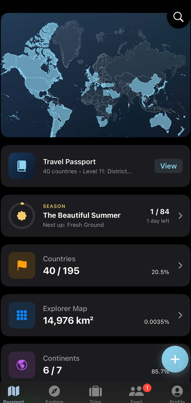
Statlas is the travel tracker that maps every country, city, landmark, national park, airport and port you’ve ever set foot in, then measures how much of the planet is actually yours, hexagon by hexagon.
Coming to the App Store Free on iPhone, iOS 18 and later. No subscription, no in-app purchases.
What it tracks
More than a country count
Most travel trackers stop at countries. Statlas keeps the whole picture, and every one of these goes on your map.
The part nobody else does
Your coverage of the planet, in hexagons
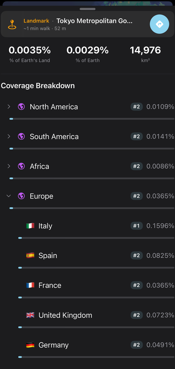
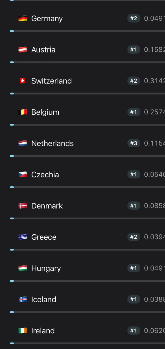
Statlas divides the world into millions of hexagons and lights up every one you’ve stood in. Not “been to France”: the actual streets, trails and coastlines you covered, measured in square kilometres and scored against the whole surface of the Earth.
The breakdown runs from continents down through countries, regions and cities, each with its own percentage and rank. Rare hexagons, the ones almost nobody has stood in, earn a rarity score. A checked-off list tells you where you’ve been; coverage tells you how much of it you’ve actually seen.
How it works
Four ways your map fills in
Forward a booking email
Send a confirmation to Statlas and it reads the flight, hotel, car or rail leg out of it and files it into the right trip. Most of your history is already sitting in your inbox.
Connect your calendar
If your bookings land in your calendar, Statlas picks up flights from there and builds the trip around them.
Import your Google Timeline
Request your location history from Google Takeout and hand Statlas the file. It reads the places you actually went and backfills years of map in one pass.
Let it log as you go
Turn on background location and Statlas records places while you’re there, so you’re not reconstructing a trip from memory three weeks later.
Trips
Your itinerary, assembled
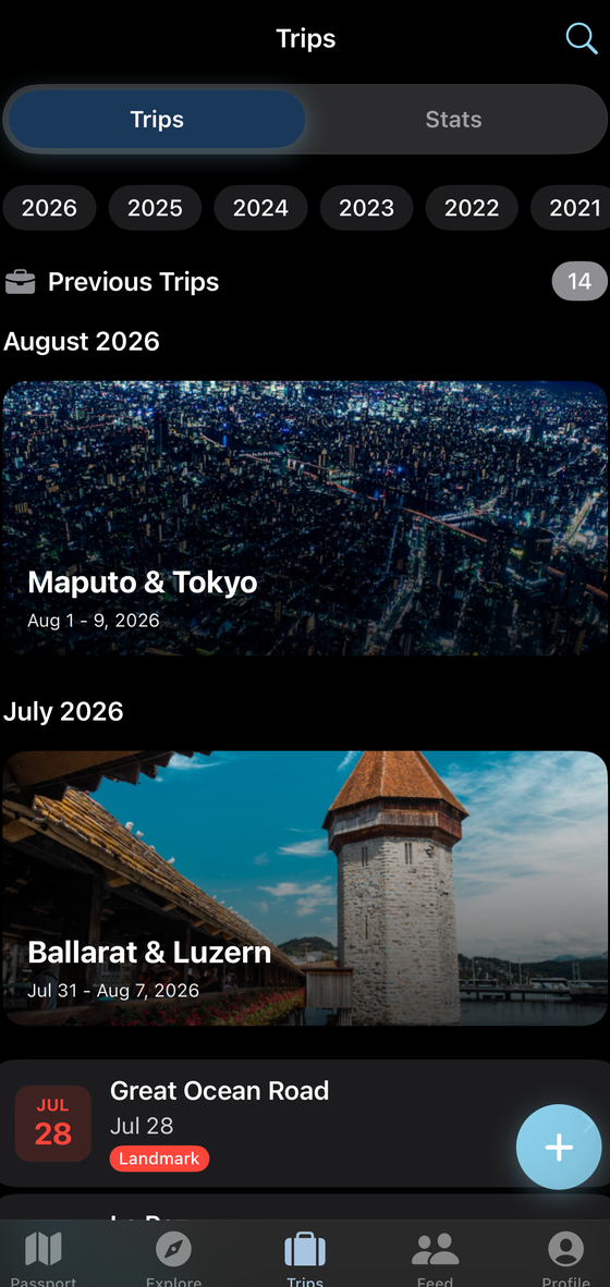
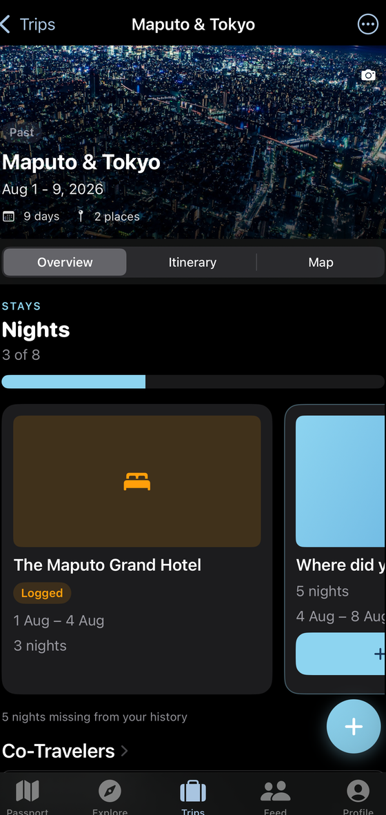
A trip in Statlas isn’t a folder you fill in. Forward the bookings and the trip assembles itself: flights with live status, hotels with nightly cost, cruises, car rentals, rail, bus, ferry and private transfer legs, in order, with the people you travelled with attached.
Every trip gets a cover photo of where you went, the nights you stayed and where, and a day-by-day itinerary. When it’s over, it stops being an itinerary and becomes part of your map.
Friends
See who is ahead
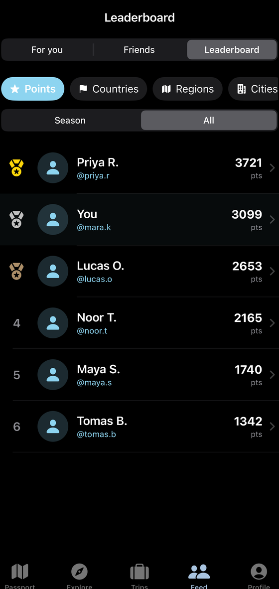
Add the people you travel with and compare properly, not from memory: who’s been where, who’s ahead on points, countries, regions or cities, who’s been sitting on 47 countries since 2019.
There’s a leaderboard for every stat, an activity feed of what your friends have been earning, and share cards for the moments worth putting somewhere other than the app.
Achievements
Over a thousand things to earn
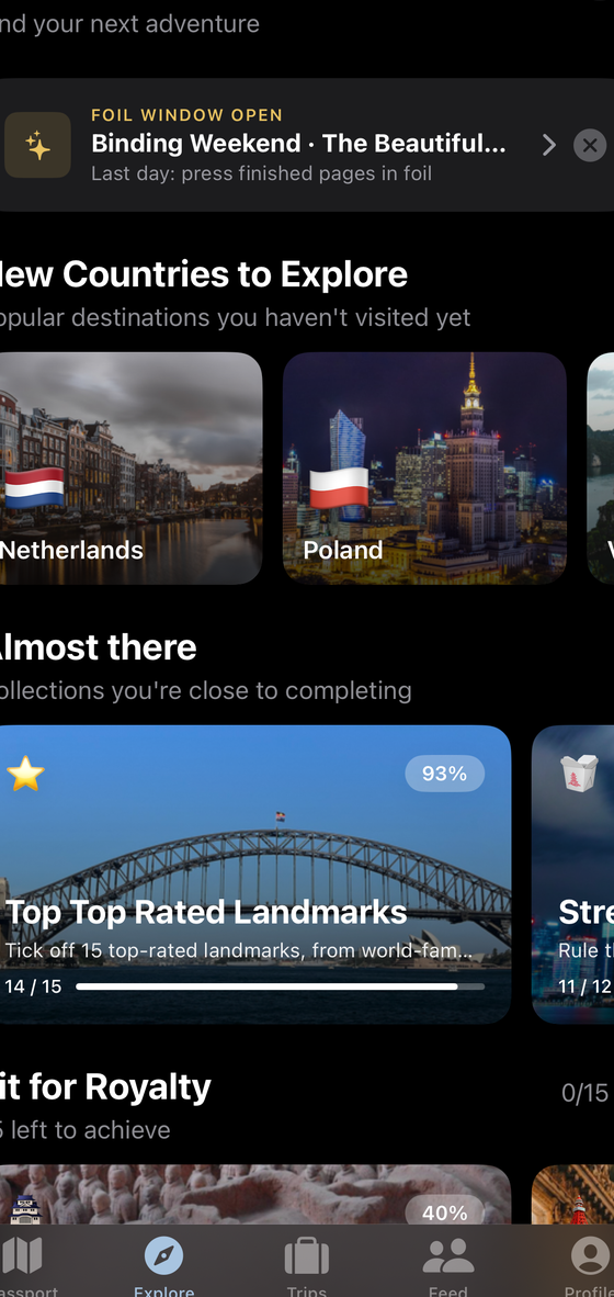
More than 1,000 achievements, grouped into collections and challenges, with levels and rankings behind them. Some are obvious: a continent, a hundred cities. Some you’ll trip over: a particular airport, a park nobody visits in winter, a chain of ports along one coast.
Statlas also watches what you’re close to. Sitting at 14 of 15 top-rated landmarks, it will tell you, and tell you which one is missing.
Counting
How many countries is a real argument. Statlas lets you settle it.
Ask three travellers how many countries exist and you’ll get three answers. Statlas doesn’t pick one for you. Choose UN member and observer states, or all countries and territories, the version that counts England, Scotland, Puerto Rico and Hong Kong separately, and every total in the app recalculates against the standard you chose.
Regions, cities, places, UNESCO sites and parks each keep their own running count beside it. Change your mind and change the setting. Nothing has to be re-entered.
Location and privacy
A permission doing real work
Background location is how the coverage map and the time-lapse get built, so Statlas asks for it and then uses it. Whether Statlas can see your location at all is controlled by iOS, in the Settings app, not buried inside ours.
The iPhone app has no third-party analytics SDKs, no advertising SDKs and no data brokers. What we collect and who processes it is written out in plain terms in the privacy policy.
Questions
Common questions
What does Statlas cost?
Nothing. Every feature is available to every user, there is no subscription, and there are no in-app purchases.
Which devices does it run on?
iPhone, on iOS 18 or later. There is no iPad app and no Android app.
Can I use it without sharing my location?
Yes. Skip the location permission at setup and add places by hand, or bring them in from booking emails, your calendar or a Google Timeline export. The one thing that needs location is the hexagon coverage map and its time-lapse, which are drawn from recorded location points.
Do I need an account?
Yes. Statlas syncs your travel history across your devices, so it needs an account. You can sign in with Apple or with Google.
How do I get help?
Email support@statlas.app, or read the support pages.
Start with the map you already have
Forward one old booking email and watch a trip appear on it. Then go complete the world.
Coming to the App Store Free on iPhone, iOS 18 and later.